Tag Archives: 2015

New Boston NH to the Mohawk Trail Mass

Milton, New Hampshire

We stayed at Friendly Beaver Campground near New Boston.  The temperature dropped quickly after dark.  I pulled the water hose inside and ran the tank heaters overnight.  The temperature had dropped to 27 degrees around 8 am.  The sky was overcast and threatening rain.  There are any number of routes we could take to get from New Boston to Charlemont Massachusetts on the Mohawk Trail.   Ellen and our GPS agreed that we should go south through Milford NH.


DSC07281

Downtown Milford New Hampshire

Milford is a much larger town than we had expected after seeing New Boston and other “towns”.  Yes, it was cold and cloudy, but we had to walk the town and perhaps have lunch at a cafe.

DSC07284

Main bridge over the Souhegan River

DSC07294

The Souhegan River looking North

DSC07293

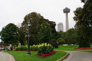
The Souhegan Park, Milford NH

Most small towns in New England were founded on rivers or lakes.  Milford is no different.  It sides astride the Souhegan River.  If you walk across the bridge heading out of town, there is a wonderful park to your left. We walked the park, then went back into town.

DSC07296

1794! History Abounds in New England

DSC07297 DSC07300

Eagle Hall, Milford New Hampshire

Local news reported that the foliage in the Merrimack Valley was at peak now.  The foliage turned a week or two later than typical this year.  The trees turn color when the temperature drops near or below freezing.  Record high summer like temperatures three weeks ago delayed fall.  We are now in the grip of a cold front pushing in from Canada.

DSC07306

We held off choosing where to have lunch until we had walked the town oval.  We happened by “the best pizza in New England” and had to stop in.  It was empty but for a couple waiting for their order. Anthony walked out from the back and asked, “Can I help you?”.  we talked about their pizza, the shop, and the town a bit.  Ellen noticed an “Eat in or take and bake” sign and asked about taking a pizza to go.  We settled on a fresh tomato pizza with added red peppers and pepperoni.  Anthony said he would hold off making the pizza for 45 minutes and that we could pick the pizza up later.  No need to pay for it now!   I won’t be here then, my sister will make your pizza. Great!  Off we went in search for lunch.  The pizza would go in our ‘fridge for dinner later.


DSC07309 DSC07310

The Best Pizza in New England!?!

We looked for a prominently advertised Union Street Grill, but couldn’t find it.  Ellen stopped two women and asked about the restaurant.  One pointed out the location, almost out of town, the last building on the left.  Then she said, ” we’re going to the diner for lunch and they have good.”  We parted ways and found the Union Street Grill and noticed only one couple at a table. We decided to skip this one and headed off to the diner.


DSC07315 DSC07316

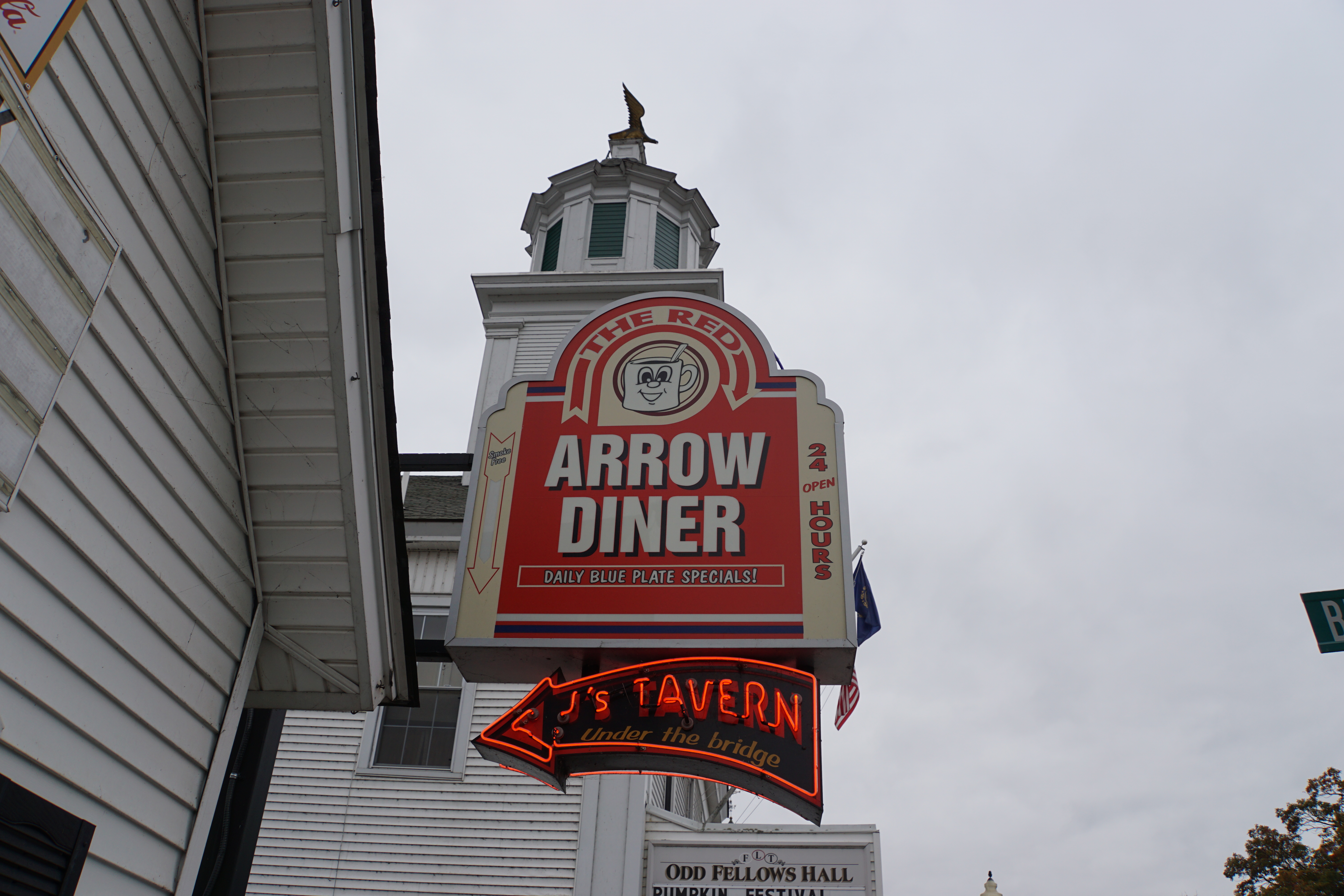
Lunch at the Red Arrow Diner, Milford

We ate at the diner, though the tavern below the diner and under the bridge would have been a better choice.  They’re co-owned and share the same menu.  The diner is a typical 40’s place where the tavern has a warmer vibe.  Oh, and the tavern has a full bar.

DSC07317

The Tavern below the Diner

Back at Foodies, Abigail made the pizza for us while we talked with the owner.  He had owned two pizza places, but bad management at his other store forced him to close it.  He has the one shop.  The pizza arrived, looking great heaped high with cheese.  Then Abigail realized she had forgotten the pepperoni!  She took the pizza back and returned with the pizza piled higher with cheese! It was huge.  Our conversation with the owner wound down and I made to pay for the pizza.  He said, “I thought you had paid already!”.  “No.”  He then gave us two free sodas: one Lime Rickey and one Root Beer.

Heading out of town, we passed a still pond and we took these photos.  There’s a small commemorative park alongside the pond.

DSC07277   IMG_7339

At a Small Park aside a Pond South of Milford

Driving along there were cones on the road and signs stating “Beware Of Runners”.  Further on, Ellen saw a covered bridge to our right.  A great place to U-turn appeared on my left and we headed back to find Potanipo Lake in Brookline New Hampshire.  There’s plenty of parking near a boat ramp on the lake.  The covered bridge is over a stream that runs into the lake.   There were a number of people milling about that appeared to had just finished running a race.  There was a cone at the end of a smaller bridge that served as the turn-around point for runners.  As we walked to the bridge a number of runners turned around the cone and ran off.  Ron asked a woman, “How long is the race?”  She said, “one hundred miles, or whatever you want to do!”.  “how far are you going?”  She answered, “A measly forty five miles.”

It was a chilly day for a race….

DSC07318   DSC07332

Potanipo Lake, Brookline New Hampshire

DSC07320   DSC07321

Pedestrian Bridge, Brookline New Hampshire

DSC07330

Foliage at the Lake

Some time later we drove into Massachusetts.  SR 31 through New Hampshire is a wonderful road.  It’s smooth with minimal bumps or repaired potholes.  Not so for the first dozen miles or so in Massachusetts.  The road was horrible with an extremely high crown and bumps, shimmies, and shakes.  On par with roads in Indiana.

Some miles later the road smoothed out, but the high crown remained for much longer.   We skirted Fitchburg taking SR 2 west toward Miller’s Falls, Shelbourne Falls, and the Mohawk Trail.
DSC07334

Into Massachusetts, Townsend 1732!

As usual, most of the campgrounds along our route were closed.  Even those listed as closing in late October had closed.  There was one campground that listed November 1 as their last day open.  Ellen called and yes they are open and yes they have sites for a 24 foot RV.  We continued on SR 2 to Charlemont Mass. and the Country Aire Campground.    Art and Lisa greeted us and checked us into a site with clear view to the south, cable, water, and electricity for $25.  We opted to stay two nights.  There are a number of small towns along the Deerfield River to explore.  We’re not due to meet Ed O’Neil until Monday and we’re less than an hour away.

Setup went quickly.  We pre-heated the convection oven to 375, placed the pizza directly on the glass carousel, and popped it into the oven.  Instructions suggest cooking for 12-15 minutes until the cheese freckles.  It took longer than 15 minutes, but finally sometime after the cheese melted it began to freckle.  It was tricky getting the pizza in the oven and again getting it out, but all went perfectly.  The pizza was perfectly done.  The crust was crisp and crunchy, the toppings cooked through and very hot.  It was a great pizza.  We’ll cook many more in the convection oven.

That night it rained cats and dogs.  The temperature hovered around 44 degrees. We were snug in The Beast.  We ushered out another Wonderful Day, looking forward to our next day’s adventure.

Stowe Vermont, Fall Foliage, Mountain View Campgound.

Stowe Vermont
IMG_6831

The Beast & Dirt Roads

Our campsite is available for another two nights and we’re staying.   It was cold this morning.  The day was nearly schizophrenic; it was comfortably warm in the sun and downright cold in the shade.  We met our neighbor, Jean Franscios, who is an IT guy working for a tech company in Montreal.  We chatted with Jean some then headed off to Stowe.

Mountain View Campground, Stowe Vermont

The campsites at Mountain View Campground are nothing special. They are flat with full hookups and a clear view to the south for Sat TV, but they provide little privacy, the bathroom heat is inadequate to the task, there is hot water though I did not use their shower after seeing how water pressure dropped in the morning.   The main reason we’re staying is its proximity to Stowe and the surrounding area.

The folks running the campsite are very nice and always available, if needed.

Today we explored side roads north of Stowe.  We were surprised when the paved road became dirt, but we drove on.  We avoided a dirt road named “Mud City Loop” and turned back when the two lane dirt road we were on funneled into a single nasty looking lane.  The roads wound through pastures and farm land between colorful rolling hills.   Northern New York and Vermont have an idyllic feel to them in the fall.

IMG_6840

Dave had mentioned that “the Mountain Road” was the place to find a restaurant for lunch or dinner.   The Mountain Road is the local name for state route 108.  After our tour north of Stowe, we drove to the town of Stowe.  Three main roads lead into Stowe; 100 North, 100 South, and 108.  All three were bumper-to-bumper with slow moving traffic.  It’s Columbus Day Weekend and an Arts and Craft Fair drew a crowd.  We looked for likely places to park “the Beast” as we crept through town then drove out on 108.  We found a small parking lot on the north side of 108 just out of town and parked easily.  This is a great place to park an RV.  The walk back to Stowe’s town center is short and there’s enough room for a forty footer or two.  We had lunch at Rimrock’s Mountain Tavern.  Ellen had the New England Clam Chowder and an Apple and walnut salad.  I had a Chicken Caesar Wrap with Cajun fries.  All the food was great.  The Cajun fries were very spicy.

DSC05637

Off the Beaten Path

Central Stowe is quintessential Vermont.  it is a very small and easily walkable. The homes around the town are set on acres of land, some set into trees in the rolling hills, others on pastures in the valleys.  It would be a tranquil place without the hoards that descend on the weekends.  Distances in Vermont, New Hampshire and Massachusetts are short.  It is not unusual for families to drive from Boston to summer homes in Vermont every weekend.  Stowe has grown over the years as tourist impact on the town has grown.  There are now numerous restaurants serving weekenders.  I hope to talk to a few old-time residents and ask how changes in the town have changed their lives if at all.  Does the influx of money, economic growth, and higher real estate prices benefit them?  Is the traffic congestion “downtown” drive them crazy?  Do they live far enough from downtown that weekend madness is not an issue?  Lots to consider.

IMG_6839   IMG_6835

I like Stowe.  There’s a home on the market that could easily be converted to a B&B.   I would never run a B&B myself.  I have no problem considering setting up a B&B as a business; hiring managers/caretakers, setting up reservation systems online, budgeting income and expenses. That could be fun.  I took a photo of the property on an iPhone, posted below (sorry about the reflection in the glass window).

IMG_2312

Potential B&B?

It is now the next morning, 10/11.  Yesterday was a short day; we left our campsite late and returned late.  We missed sunset while getting diesel and restoring our supplies.  Luckily it is very easy to setup and tear down “camp”.  Often we just connect or disconnect a hose and electric cable, then run down our “pre-flight” check-list.  I always take a walk-around to be sure we’re good to go before starting the engine.   We’re starting that process now with plans to visit the gondola to the top of Mansfield Mountain and perhaps drive to Smuggler’s Notch.

Here are a few photos we took in and around Stowe yesterday.

DSC05653

Off the Main Road, Stowe Vermont

DSC05648   DSC05636

Cinderella, Niagara Falls, Walk to Canada, Syracuse NY

Niagara Falls

Cinderella Motel and Campsites

DSC03914

Cinderella, Beast Style


DSC03918

Cinderella Campsite Common Area

We awoke early, planning to run up to Niagara Falls and beat the crowds.  My watch showed 10:30 local time.  We were anything but early.  I walked the campground and took a few photos while Ellen setup to leave.  The campground is visually appealing with stands of trees, an open-sided meeting building centrally located, and showers and laundry.

Sewer Trouble

We took the slide-out in and were ready to go.  Checking tank levels, it made sense to drain the swamp before we left.  I moved the Beast closer to the drain and hooked it all up.  After watching this video, Comparing Tank Flushers in the Clear RV Black Tank, I chose use a clear elbow with a flush connection and a valve ( like this ) attached to the hose running into the drain for our RV setup.  The idea being to open the clean-out valve, drain the black, close the clean-out valve and back fill the tank, open the clean-out valve to flush the tank and repeat until the tank runs clear. Then I’d do the same for the gray tank.  Easy!

With the black tank valve open, the hose filled up and refused to drain!  Great, the campsite drain was plugged up and would not drain.  Now  I’ve got a 3 inch tube full of poo.  I thought for a while and realized I could pressurize the hose and perhaps force the obstructed drain clear.  To do this I closed off the black valve and turned on the water  which pressurized the hose.  This inflated the hose, showed a number of pin-hole leaks which were now small geysers, and forced fluid out around the drain fittings.   FAIL.  I opened the black tank valve to relieve pressure, then closed it and closed the flush valve.  Now I could disconnect at the RV without the entire hose emptying out.  I moved the hose away from “everything” and emptied the hose.  What a mess.  It was 12:30 now and the Cinderella office was closed.   After cleaning up as best I could, we headed off to Niagara Falls.

<<<<<  No Photos of this Disaster >>>>>

Walking to Canada

IMG_6418   DSC03929
Shots from the Rainbow Bridge Walking into Canada

DSC03850

The American Falls from Rainbow Bridge

We drove into the same lot we had parked the evening before.  Took a ticket and looped around to find a double spot.   As I was pulling in, I saw an attendant hurrying toward me waving his arms.  We were told that we could not park there, but if we go out there, take a right, then another right, then the first exit from the rotary down the road, we’ll find parking lot #3, free parking for RVs.  Parking Lot #3 is way out in the boonies.  It is free, but it would be a long walk back to the Rainbow Bridge to cross into Canada.  There is a shuttle that runs throughout the park.  For $2 per person, you can get on and off the Shuttle as many times as you want in a day.  We opted to take the Shuttle and got off at the 2nd stop near the base of the pedestrian bridge.  Proper documentation is necessary to cross into Canada, a driver’s license is insufficient.  We took our passports.

DSC03976

Maid of the Mist

The view of American Falls from the Rainbow Bridge is breathtaking.

IMG_6440

the American Falls

We passed a number of couples and groups walking back toward the U.S.   Typically Americans commercialize tourist destinations, often to excess.  It has been forty or so years since Ellen or I  last visited the falls.  In that time the American side of the falls has been developed, but not commercialized.  It has a few new buildings in the park: the Aquarium for example.  The Canadian side looks to be a full city.  There are at least two casinos, hotels, restaurants, and an esplanade along the gorge leading toward the falls.  The esplanade has a formal gardens, lawns, and wonderful plantings along its length.  While commercial, the Canadian side shows a sense of pride and retains a quaintness that I had not expected. The American side seemed to have  more park area.

DSC03979

Gardens and Sky Tower


DSC04054   DSC03993

DSC04018   DSC04069

Horseshoe Falls

IMG_6451   IMG_6472

IMG_6477   IMG_6482

More of Horseshoe Falls

The views of the falls from the Canadian side is not to be missed.  We did not have time to take the “Maid of the Mist” boat tour of the falls from the U.S side or the equivalent Canadian tour, nor did we walk the caves behind the falls.  We would love to come back to do them. We’re now staying with Paul and Carol in Syracuse NY,  Paul said there’s a jet boat you can take on the Canadian side that runs up to the class V or VI rapids way above the falls and that this is no to be missed.  We’ll add that to our list of things to do “next time”.  Paul said to find the jet boat you drive up the Canadian side of the waterway and you can’t miss the signs for the boats.

IMG_6434   DSC04093

Of course we were snapping photos like crazy and standing in awe of the falls when we weren’t.

DSC03930

Returning, we walked quickly back to the bridge.  We were already late leaving for Syracuse and might miss dinner!  To our surprise, there is a turnstile on the Canadian side.  You must pay 50 cents to exit Canada.  We had twenties.  There were change machines that took Canadian and US one dollar bills, but nothing larger.  We were discussing our options and being disgusted at a out further delay as couples and groups shuffled by and through the turnstiles.  I was just about to go back out to the street to find a place to change a 20 when a very gracious Swedish couple, Anne and Malton, gave us each 50 cents and we were on our way.

We caught the Shuttle.  Unfortunately, it had four stops before getting back to lot #3.  We were running later still.  If we had time we would  have further explored Niagara State Park.

DSC03975

We have a number of videos that capture the mighty power and awesome (“AFA”, you know who you are!) beauty of the falls, but they are too large to post to the blog (yeah, what’s with that?).  So I’ll move the videos to our photo album in the next few days.

Syracuse

On the drive to Syracuse, we ran into some rain but no construction on 90 east of Niagara.  Our GPS worked beautifully and we arrived at Paul and Carolann’s home almost two hours later than we wanted.   Their son, Dillon, had not yet arrived; we had not missed dinner.

We’ll stay here in Syracuse for a few days visiting with Paul and Carolann, then head off toward Duchess County; Rhinebeck, etc., to meet more of Ellen’s family.

Ron & Ellen  a stone’s throw from fall foliage in the north east.