Category Archives: Uncategorized

Off to LichtsinnRV, Forest City Iowa


We sold Little Beast, our prized motor home.  We flew to Crowley RV in Connecticut in February, 2015 during a very cold winters to purchase Little Beast.  This year, 2021, we are driving to LichtsinnRV in Iowa to purchase our new “Little Beast”.  We delayed delivery a week to avoid a record setting cold front that had Texas seeing –50 degrees Fahrenheit! As MM said, “déjà vu all over again”.

Our steed was a 2021 4 wheel drive Chevy Equinox.  I was extremely surprised at how well the Equinox performed in terms of gas mileage, power, comfort, and electronic enhancements.  If I were to purchase an internal combustion engine auto, I would actually consider one of these.

We decided to drive to outfit our new motor home with the items we loved in Little Beast,  Most everything fit in the Chevy,  I had to leave a few large items behind.

I had hoped to drive through to Salt Lake City, Utah the first day.  The first day took us 120 miles short.   My target for the second day was North Platte, Nebraska.  Cynthia, a close friend, suggested we stop in Kearney, Nebraska to see the annual Sand Crane migration.  These cranes migrate from South America to Canada Alaska, and even Russia.  Between February and April, they stop-over in the North Platte river valley to feed before continuing north.  It is estimated that 600,000 cranes make this trip every year.  We had no idea.  We would have noticed the flights of “birds” overhead and wondered what was going on.

We stopped at Kearney’s tourist information building (which was closed) and happened to catch a fellow who was just leaving.  He stopped, spoke with us a bit, let us into the tourist center, then talked sand cranes with us for a bit.   We left with a map and locations for likely sightings.  “They are out there, I saw maybe 10,000 of them this morning.  But you never know where they will be.”   Two of his three recommendations were chock full of feeding cranes with more dropping from the skies every few minutes. 

The third site he recommended was a bust and probably would have remained so, but for Ellen.  She stopped a couple and asked “how was it?”    “Oh there is nothing to see there now, but if you come at sunset or sunrise, you will see the cranes congregating.  We arrived just at sunset this morning and that was just too late.  Even so, sunrise over the river was idyllic. Be sure to be here well before sunrise.”   We walked to the pedestrian bridge over the North Platte river and saw…   no birds. 

We stayed at the Western Inn and were up at 5AM.   We grabbed espresso at Scooters and headed off.  We walked to the bridge well before sunrise.  We could hear the cranes cooing about a quarter mile distant.  They rose as one about 15 minutes before the sun rose and flew back and forth over the river a number of times.  Slowly flights of a few hundred at a time pealed off and went their own way.   It was fascinating to see how one chevron of cranes would join another; how the lead bird of one flight would join an arm of another flight.  How is the lead bird “chosen”?  Is there a pecking order? Do some birds vie for dominance?

Here are a few photos of the Sand Cranes taken on 3/10/2021 and 3/11/2021

IMG_2037

Sand Cranes “On Approach”


IMG_2043


IMG_2044

Feeding in a local field, Kearney


IMG_2088

A Pair of whooping Cranes, very distant


IMG_2104

A Vast Number of Sand Cranes (expand the photo)


IMG_2135

A Chevron Forming Up


IMG_2138

Expand the Photo

IMG_2143

Cranes in Flight, Everywhere We Looked


IMG_2167

Sunrise on the North Platte River, “Too Late”

It’s been a minute!

I’ve taken a long hiatus from this blog.  I’m BACK!

Covid is wreaking havoc on the world, We have unprecedented wild fires in California, a string of hurricanes hitting the gulf states, and political tribalism “like you’ve never seen before”.  2020 has been a “banner” year thus far.  I’d like to bury my head in the sand, though that’s no way to cope.

Our vacations are on hold as we hunker down.  We’re selling our 2015 Winnebago View 24J and are ordering a 2021 Winnebago View 24D.  From an investment point of view, we should keep the 24J.  It’s been barrels of fun for us.  However the queen bed and new sprinter safety features lured my wife from the 24J.  Too the new models have integrated solar and a lithium battery option.   We’ll sell our 24J first.

We were in Morocco about to head into the Sahara, when we about faced and headed Casablanca’s airport to head home.  What a zoo the airport was.  Hundreds of people waiting in line (pushing and shoving sometimes) trying to get on the standby waiting list.  Air France was the only carrier flying out of Morocco.  They prioritized French Nationals, followed by EU citizens.  For four days we arrived at the airport extremely early and left late.  One night we were near the front of the line and actually slept in the airport expecting to be first in line the next morning.  That didn’t happen as a bus load of Moroccans stormed the counter demanding service.  It was bedlam.   After some days our tour company worked an agreement with Air France. We loaded onto busses in the early morning darkness and drove to Marrakech for our flight to Paris.

Once home we took the pandemic seriously and self quarantined at home for months.  We’re only now extending our safe bubble to family and a few friends.

Our international travel plans are trashed for the next year, perhaps longer.  We will resort to extended motor home trips across the nation.  There hundreds of other people purchasing their first RV to enjoy traveling while self isolating. There is a Covid RV Sales boom nationwide.  This is the perfect time to sell a used RV and to purchase a brand spanking new one.   The one good thing (for us) to come out of 2020.

Erroneous Entry, “Glacial Etching” in Zion NP

I’ve been reading about the geomorphology of southern Utah.  Present understanding of the Pleistocene Epoch does not have glaciers extending into southern Utah.  In particular, the “glacial etching” caption on a photo from Zion NP is in error.  Mountain tops in southern Utah may have had glaciers form on top.  The etching shown in the Zion photo is from facial horizontal deposition fragmentation and horizontal fragmentation.  It does form a striking checkerboard pattern, but it has nothing to do with glaciation!

A Whimsical Pictorial Recap of Our Trip

Day 1, Ashland Oregon

IMG_2572.jpg (1024×768)

Day 2, Toutle River RV Park, Oregon

image

Day 3, Mt St Helens Obscured By Clouds

IMG_6884.jpg (1024×768)

Day 4, Hama Hama Seafood, Hood Canal Wa.

IMG_6907.jpg (1024×768)

Day 5, Victoria BC

image

Day 6, Victoria BC

IMG_2605.jpg (576×768)

Day 7, Victoria BC

IMG_6996.jpg (576×768)

Day 8,, Butchart Gardens, Victoria BC

IMG_4084.jpg (1024×683)

Day 9, Victoria BC

IMG_2790.jpg (1024×768)

Day 10, Friday Harbor San Juan Island

IMG_7537.jpg (1024×768)

Day 11, Lakedale Resort San Juan Island

IMG_7591.jpg (576×768)

Day 12, Deception Pass State Park, Washington

IMG_2853.jpg (1024×768)

Day 13, Coupeville Whidbey Island Washington

IMG_7712.jpg (576×768)

Day 14, Coeur D’Alene Idaho

IMG_E7823

Day 15, Coeur D’Alene Idaho

IMG_2921.jpg (576×768)

Day 16, Coeur D’Alene Idaho

IMG_2931.jpg (576×768)

Day 17, Coeur D’Alene Idaho

IMG_7848.jpg (1024×768)

Day 18, Coeur D’Alene Idaho

IMG_2984.jpg (1024×768)

Day 19, Coeur D’Alene Idaho

IMG_8040.jpg (1024×768)

Day 20, Missoula and Butte Montana

IMG_8061.jpg (576×768)

Day 21, Bozeman Montana

IMG_8128.jpg (1024×768)

Day 22, Bozeman Montana

IMG_8307.jpg (576×768)

Day 23, Yellowstone National Park

IMG_1055.jpg (1024×768)

Day 24, Yellowstone National Park

IMG_8399.jpg (576×768)

Day 25, Yellowstone National Park

IMG_1139.jpg (1024×768)

Day 26,, Yellowstone National Park

IMG_E8648.jpg (605×768)

Day 27,Yellowstone National Park

IMG_3319.jpg (1024×768)

Day 28, Yellowstone National Park

IMG_0138.jpg (1024×683)

Day 29, Yellowstone National Park

IMG_9039.jpg (1024×768)

Day 30, Gardiner and Points South

IMG_3331.jpg (1024×768)

Day 31, West Yellowstone

IMG_1323.jpg (576×768)

Day 32, West Yellowstone

IMG_1347.jpg (1024×768)

Day 33,  Hayden Valley

IMG_0216.jpg (1024×683)

Day 34, West Yellowstone

image

Day 35, Grand Teton National Park

Day 36, Fireside Resort Jackson Wyoming

IMG_3421.jpg (1024×768)

Day 37, Points South

IMG_9985.jpg (576×768)

Day 38, Points South

IMG_0118.jpg (1024×768)

Day 39, Capitol Reef National Park, Utah

IMG_1488.jpg (1024×768)

Day 40, Capitol Reef National Park, Utah

IMG_3480.jpg (576×768)

Day 41, Escalante National Monument, Utah

IMG_0852.jpg (1024×768)

Day 42,  Escalante Utah

IMG_1745.jpg (1024×768)

Day 43, Escalante’s Slot Canyons

IMG_3548.jpg (576×768)

Day 44, Bryce Canyon National Park

IMG_4594.jpg (1024×683)

Day 45, Bryce Canyon National Park

IMG_3675.jpg (576×768)

Day 46, Zion National Park, Utah

IMG_1562.jpg (576×768)

Day 47, Zion National Park, Utah

IMG_3850.jpg (576×768)

Day 48, Valley of Fire State Park, Nevada

IMG_0274_cropped.jpg (1024×617)

10/28/19, Valley of Fire, Petroglyphs, Day 48


IMG_2022

Atlati Rock Campground, Valley of Fire State Park

IMG_2027

IMG_3890

Stairway to Petroglyphs, Atlatl Rock, Valley of Fire, Nevada

IMG_4771

IMG_4767

IMG_4772

IMG_0264

IMG_0274_cropped

We awoke around 7:30, typical for us.  We waited until the couple tent camping beside us were up before making coffee.  When we’re not on “shore power” we’re forced to run our generator to make coffee.  The Cummings generator is notoriously noisy.

We headed toward the visitors center, but stopped at a turnout and discovered the petroglyphs at Atlatl Rock.  We didn’t take time to hike Petroglyph Canyon Trail to Mouse’s Tank.   We’ll save that for another trip, another time.

The visitors center at Valley of Fire is remarkably well done for a state park.  Then again Valley of Fire is Nevada’s first state park.  The taxidermy mounts include snakes and reptiles along with big horn sheep and a cougar or two.  Less information was devoted to the geology of the area.

Outside we noticed a Ewe moving through a stand of sagebrush.  Then we saw Ram following along.  He had massive circular horns.  I headed back to Li’l Beast for my long lens.  In the meantime the two sheep walked some distance.  They walked together and joined a band of maybe fifteen big horns.  All were ewes or yearlings but for the single ram.   

We watched for a while and considered walking closer, but we didn’t.  Instead we walked back to Li’l Beast and headed off to San Diego and Ellen’s daughters.  Our adventure had drawn to a close.  A number of people, rangers and locals, had said that springtime is magical; magical in Yellowstone, in Grand Teton, in Capitol Reef, Escalante Staircase, Bryce, and Zion.  But for Orca viewing, go in December!   I’m not sure we can work in a 2020 spring road trip.  Our planned trip to Africa and Europe in April is definitely a conflict.

Once again we’ve had a great time traveling around the U.S.  We’ve had rain and snow, cold weather and warm, and many beautiful sunny days.   Each day has been an adventure, often enhanced by talking with locals.  What fun this has been.

10/27/19, Zion National Park, Petroglyphs, Valley of Fire, Day 47

We’re bumping up against Ellen’s desire to visit her daughters in San Diego and a hard date to be home, 11/4. Zion NP is vast. Under “normal” circumstances we would plan a few long hikes over a number of days here. As it is we’ll hike with Jim & Cyn today and push on toward San Diego in the afternoon.  We met for coffee and croissants at Deep Creekk Coffee Company.  Their croissants are wonderful, though service is unusually slow.

IMG_4700

Zion National Park

I was disappointed in Zion Canyon Campground and RV Resort.  Our morning hikes would extend into the afternoon.  I asked for a late checkout at the campground.  “We do not do late checkouts”  What if I paid extra to stay a few hours longer?  “We do not do late checkouts”.   We often ask for late checkouts as we travel the U.S.  We have never been denied a late checkout before.  Even at Salish RV Resort in Victoria which is very popular, we’ve had no problem.  But at Zion we were denied!  Bummer.  We parked Li’l Beast at our friends house and headed off.

Hiking in Zion is often along dry riverbeds or across open fields of slickrock.  In the fall cotton woods turn vibrant yellow and the few maple trees turn red.  Our first short hike was up a dry wash to a stand of maple trees. This year the cotton woods were “confused”; some were beautifully yellow, some had not yet turned, others were past prime.  The maple trees were past prime, though full of red leaves.   On the way back we happened upon a bird whose head bobbed above then dropped behind a rock repeatedly.  The woodpecker seemed to be rooting through the sand.  Is this common behavior?  I have no idea. It was fun to watch.

IMG_3850

Some Red among the Rocks

We took a second short hike to view petroglyphs.  I find this early American art fascinating.  It seems clear the pictographs represent water, rain, and local wildlife.  Are drawings of bear and big horn sheep reverential, utilitarian, or both. “Doesn’t tis one look like two people having sex?”  Like most art, these petroglyphs are open to interpretation.  Petroglyphs are scattered throughout southern Utah and northern Arizona.  We had a fun if short day with Cyn & Jim.

IMG_4743


IMG_4744

Anthropomorphs

IMG_4747

Zoomorphs

IMG_1691

Textured Rock, Zion NP

IMG_4753

Red on Red

IMG_3860

A Local Resident, Zion NP

IMG_3864

Some Color along the Road


Nevada

IMG_1819

IMG_1874

IMG_1929


Valley of Fire, Nevada

Driving on, we chose to stop at Valley of Fire outside Las Vegas, Nevada on Cyn’s recommendation.  The drive away from Zion was typical of the Colorado Plateau. Once we turned away from the Virgin River, the land became relatively flat with not a hint that dramatic rock formations stand nearby.   This went on for some miles, then the road winds up and down through steep canyons with dramatic rock walls.  This goes on for miles before dropping into an open plain.  The plain continues on toward Valley of Fire.  We drove past extremely small isolated towns “in the middle of nowhere”.  Approaching Valley of Fire we saw a group of motorhomes parked on a bluff overlooking the road.  “We may be dry camping tonight.” I said.  We were approaching the state park late in the day. 

Valley of fire is a dramatic red rock outcropping. It is such a contrast to the nearby landscape.  Our thinking went from “what have we gotten ourselves into”  to “Wow, this looks great”.

The park entrance kiosk was closed.  We drove on past the visitors center looking for the campgrounds.  “Maybe we’ll get lucky.”  I drove past the campground road, U-turned, and found a “campground full” sign.  We’ve seen this before.  Never, never believe a campground full sign; always stop and ask.  A barking dog announced our arrival at the campground host’s trailer. Dominic popped outside.  “There could be a site open.  Drive around. If you find one, be sure to put a chair or something on the site if you leave.  Site 17 hasn’t been occupied in a few days”   There are two routes around the campground.  We found site 18 open on our second loop through. 

All of the developed sites were taken.  Site 18 is a dry site. I asked Dominic about campground rules for generators.  “You can run a generator between 7 AM and 10 PM”.  Great we’d have coffee in the morning though I’d wait ‘till 8am.


IMG_1983

10/26/19, Zion National Park, Springdale RV Parking, Café Soleil, Day 46


The Colorado Plateau amazes me.  It can seem so flat, you’d think you’re in Iowa.  That flatness gives way to massive rock formations and canyons terminating in the Grand Canyon to the south.  I’m reading an elementary book about the geology and geomorphology of Southern Utah. It’s academically rigorous citing a vast number of primary sources while being approachable for a novice (me). 

Bryce to Zion

Friends of ours own a house in Springdale.  They planned to be “home” today and Ellen expected to meet with them in Springdale.  It is a short drive from Bryce National Park to Springdale that passes through Zion National Park.  Where Escalante has vast plains with canyons and narrows and Bryce has a dramatically eroded expanse of hoodoos, Zion has soaring walls scrubbed smooth in past ice ages.  Zion also has canyons and slot canyons.  While smaller than the Escalante Staircase, Zion is much larger than Bryce National Park.  Because of their size, it takes some time to come to terms with both Escalante and Zion.  A drive through is not sufficient.  On a drive both look impressive, but you would miss those hidden gems that make them unique.

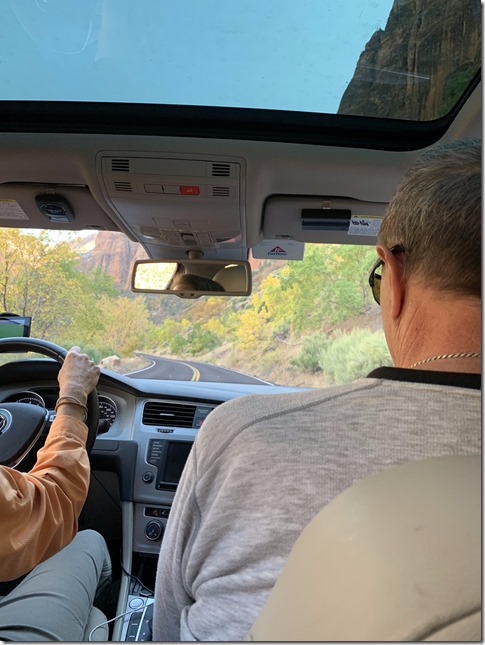
We drove directly from Ruby’s RV Park, Bryce to the entrance to Zion National Park.   Past Red Canyon and Dixie National Park, the landscape was unremarkable.  Driving into Zion National Park,  the landscape changed.  We dropped into canyons with steep and colorful walls.

IMG_1487

On the Road to Zion NP from Bryce NP

IMG_1499

Rolling Hills, Buttes, and pasture land of Southwest Utah

IMG_1501

Zion National Park’s Entrance and Noticeably Different

IMG_1506

Glacial Etching in a Canyon Wall

IMG_1511

A Typical Canyon Wall, Zion NP

IMG_1522

And Another

We were told that we’d have to pay a $15 tunnel fee.  A tunnel runs to the south side of the park.   It is the only way south and it can accommodate thirteen foot high vehicles if they drive the center line.  A ranger checked our paperwork and held traffic while we drove down the center of the road. Li’l Beast could not navigate the tunnel otherwise.

IMG_1562

Driving the Center Line, Zion NP.

IMG_1568

Traffic waiting for Us to Pass!

There is a steep S-bend descent from the tunnel to the valley floor and out of the park to Springdale.   Zion at this time of the year is busy.  Not as crazy as the summer, but busy enough that we had trouble finding parking in Springdale.  With temperatures the past week below freezing, I wanted to have an electric hookup for the night.  Temperatures were not projected to be below freezing.  Still I thought it prudent to have a hookup.

I found a parking lot for oversized vehicles for $20 for the day and $40 for overnight parking, but dry camping without electricity. The one RV park in Springdale, Zion Campground and RV Resort, was across the street.  I made a beeline to them.  We both thought there was no way they would have space for us this late in the day.  They had a space for Li’l Beast!  That was remarkable.   We parked in our site and walked off to meet our friends at a Café Soleil, a short walk away.

Lunch was very good.  We reconnected with our friends talking a bit about our trip.  After lunch we went to their custom built home.  It is a gorgeous home with massive picture windows opening onto Mt. Kinesava.  We hung out chatting and planning tomorrow’s activities. For dinner we drove back to Springdale to the Bit & Spur Restaurant and Saloon for dinner.  They serve great “comfort food”.  I had Salsa Verde, one of my favorite Mexican style dinners.

Though the weather was not projected to drop below freezing, I felt it best to go back to Li’l Beast for the night “just in case”.  

Back at the RV Resort, I walked around the back of Li’l Beast to hookup and found our neighbors standing around a fire.  A fire echoes in our primitive collective unconscious like very little else.  “Can I help you?” No, I got this” I said.  It’s a simple process I’ve done a hundred times.  Once hooked up I asked,  “how was your day?  What did you guys do?”  We were off talking abut motor home travel, national parks, hikes, and wildlife.  The fellow I was talking to is a Boston Fireman who had quite a few stories to tell.  We were talking for fifteen or twenty minutes before Ellen came around wondering what I was up to.  Sure enough, She joined the conversation.  As the fire burned down, I took the wood we’d been carrying in Li’l Beast for the past year and added it to the hot coals.  The fire and conversation burst to life.  We chatted for an hour or so.  “Is it safe to leave the fire unattended” I asked around quiet time at 10 PM.  “Sure, it’s safe” said the fireman. 

Crawling into bed I didn’t even once consider that fire an issue.  If a Boston fireman is good with the embers, so was I.

10/25/19, Navajo Loop, Queens Garden, Red Canyon, Day 45

IMG_4626

Early to Rise?

Well, no!  Today was not one of those days.  We took our merry time getting up. We each had two cappuccinos and packed for a hike.  With the cycles locked to a rack at the RV Park, we finally headed off to the park at 11:30! 

The Navajo Loop Trail starts at Sunset Point, a very popular overlook.  We knew we were in trouble when we saw four busses in the buss parking area and cars ahead of us jockeying for a spot.  I did two loops.  There was no space for Li’l Beast. Sunrise Point is less popular, but has even less parking. We’d have to try.  Then it hit both of us, “Why not park at the lodge?”  The lodge is very close to sunset point; we’d have a very short walk to the trail head.  I turned in toward the lodge then turned up into overflow parking.  With just two other cars parked there, we were in.

IMG_3652

The Lodge Overflow Parking

The day was cool, even cold in the shade.  A light breeze rustled the trees as we set off.  We dressed in layers.  There are well worn paths from overflow parking that swing around the cabins, and go right to Sunset Point.

  IMG_1339


IMG_3655

The First of Many Portals through Wall Street


IMG_3657

Wall Street, Down In the Hoodoos


IMG_1357

They’re Massive!


IMG_3660

Canyon Ponderosa Pines


IMG_1393

A Survivor


IMG_1397


IMG_4655


IMG_3662

Stable, but for how long?


IMG_1386


IMG_1365


IMG_3671


IMG_3675


IMG_3677


Navajo Loop Trail

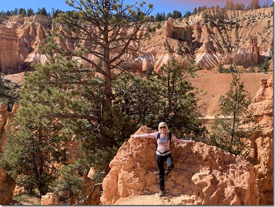
What a trail this is!  It starts with dramatic vistas over hoodoos and knife edge ridges.  The trail switchbacks down a steep wall toward the hoodoos and the valley floor.  We dropped to hoodoo height and below. The trail winds through stunning walls of red rock.  This is “Wall Street”. The Navajo Loop Trail is one of the most popular trails in the park.  There were many on the trail, though I never felt crowded.  From time to time we were alone on the trail!


International Day

It felt like international day to us!  We chatted with people from Italy, Germany, France, Spain, Korea, and China.  We met people from all over the Unites States. Franco, an Italian fellow, said he’s living in Boston and came to Las Vegas for a convention.  He had wanted to visit Bryce for twenty years.  With the convention over, Franco took a day for himself and came to Bryce.  Today was the best weather for hiking.  There was little to no wind and practically no clouds in the sky,  The temperature was comfortably cool.

I was surprised at the fir trees that have grown among the walls and hoodoos.  They’re practically invisible from the overlooks, masked by the red rock walls.  Navajo Loop Trail connects to Peekaboo Canyon Trail and Queens Garden Trail.  Han, the fellow from Holland we met Capitol Reef, recommended taking Queens Garden Trail and not taking Peekaboo Trail.  We took his advice.   “The Queen” sits high on a ridge.  She is visible from a short side trail from the Queens Loop Trail.   A few people opted not to take the walk, “It’s just another rock”.   It’s really a short walk and worth it.

The Queens Garden Trail switchbacks back up the valley wall.  Views from the trail are spectacular and make the slog uphill more tolerable. I’m told that Peekaboo Trail is far steeper.  I was glad we took the Queens route.


IMG_3663

The Queen


IMG_3700

The Olympic Torch


IMG_3704


IMG_3705


IMG_3739


IMG_3746


IMG_4692


IMG_3756

IMG_1444

A Bus Waited for Us to Pass!

Red Canyon & Dixie National Forest

“Let’s go to Red Canyon”, Ellen suggested as we readied to drive off.  We drove north on Ut-63 and west on Ut-12 toward the canyon.   We were both hungry as we passed Bryce Canyon Pines Restaurant and drove on to Red Canyon Visitors Center.  Along the way Ut-12 passes through two red rock arches.  We easily had clearance, though we saw a bus-sized RV waiting for a break in traffic before heading through.

Tour busses stop at the visitors center for a pit stop.  Two busses pulled in while we were there.  In both instances a very few people entered the visitors center.  Most hit the restroom and milled about outside.  Inside we spoke with Josh, the ranger behind the welcome desk.  He seemed uninterested as we asked a few questions about local hikes and getting to the canyon.  We asked about wildlife.  That piqued his interest.  We talked about bear and mountain lion. Deer and isolated trails in the Dixie Forest.  He spends as much time hiking in the forest as he can.  He loves being outdoors and the isolation of hiking alone.  “I’ve never seen a bear back there, but I’ve seen scat and prints!  We have black bears here.”   The center has a series of photographs of the most common plants of the region.  You’ll find taxidermy mounts of common animals as well..  I’m not a fan of taxidermy.

IMG_1455

We both felt it was too late in the day to begin a hike and skipped continuing on to Red Canyon.  Turning back, we stopped at the Pines Restaurant for lunch.   This is one of the better restaurants in Bryce Canyon.  I had a grilled cheese and ham sandwich.  Ellen had an open face turkey sandwich.   My ham and cheese was ok.  Ellen though hers was too salty.  We had a slice of cherry pie that was better than average, but not excellent.

IMG_3827

We headed back to Ruby’s RV Park for the evening.

IMG_1480

10/24/19, Bryce Canyon National Park, Day 44

IMG_3630

Kodachrome’s most Prominent HooDoo

IMG_3633

Kodachrome’s Wildest

We had planned to get an early start.  Instead we chatted with a family from New Zealand.  They had flown into San Francisco, stayed for a few days, and rented a motorhome to tour the west.  They too had planned to visit Glacier National Park.  As with us, the weather turned them south.  They’re headed to Zion and the Grand Canyon next.  He said New Zealand is a very small island.  Go a few hundred miles in any direction and you’ll hit a beach.  This country is vast.  They enjoy getting away.  We talked about New Zealand,, The differences in motorhome etiquette around the world.  In New Zealand, you cannot just park a motorhome anywhere.  However there are many free parks designed for motorhomes.  Traveling about is easy and inexpensive.  We both marveled at the Kodachrome bathrooms. 

They followed as we drove from the park.  They’re headed to Escalante and Capitol Reef next.  We’re off to Bryce Canyon.  At the fork we waved and honked as they turned right and we went left.

Bryce Canyon National Park, take one.

It’s a short drive from Kodachrome to Bryce Canyon, perhaps 45 minutes taking it slowly.  We passed Tropic, a small town along Ut-12 and a bit later turned south to Bryce Canyon  City.  We passed Ruby’s Inn RV Park and Campground to our right just before entering the park.  “Ok, we have a backup plan if the park’s campground is full.”  We skipped the visitors center and headed right to the north campground.  It was CLOSED! We drove on to Sunset Campground a bit further down the road.  It was open, but primitive: no electricity, no showers, no flush toilets.  With freezing temperatures overnight, we wanted electricity.

We drove back toward Ruby’s stopping at the visitors center on the way.  The center was busy.  There were cars coming and going and very little RV parking.  I was stunned at the people milling about inside.  We were fourth in line for the information desk as people rummaged through the trinkets and memorabilia on sale. “How long a hike do you plan to take?”, Sadie asked. For a four hour hike, she recommended the most popular hike.  The Navaho Loop Trail goes through Wall Street and connects with the Queens Garden Trail.  “That should take you about three hours more or less.”  That is the trail Han said “You have to take this trail.  It is fantastic; the highlight of our tip.”  We chatted with Sadie for a bit bout the Escalante, slot canyons, and Bryce.  She knew Peekaboo and Spooky well.  Coming back to earth,  we parted company as the information line grew behind us.

At Ruby’s RV Park, we pulled in behind a newer Winnebago sprinter van.  It was small, the size of a regular van with no slide outs.  “That looks really good”, I thought.  Inside the reservation desk, Ellen asked the van’s driver, “How do you like your RV?”  We had a big surprise!  Mike said, “I hate it. It’s too small for the two of us and we’re constantly banging our heads in the thing.  I’ve owned a number of motorhomes from 40’ to 34’.  We’re looking to downsize and thought this would be perfect.  It’s not.  I get more people asking about it than I’ve ever had with any other RV.  I tell everyone it is just too small for us.  It looks great, drives great, it’s easy to park, but it’s just too small.”   We kiddingly called them “the head bangers”.

Ruby’s had space for Li’l Beast.  Again we chatted with the four people at the desk about where to eat, weather, the campsite, and whatever crossed our minds.  As usual, we drove the park and found site # 125, nestled in some pine trees and reasonably close to the showers.

We found parking at Ruby’s General Store for supplies. We asked about restaurants and went looking for Ruby’s Inn Cowboy’s Buffet.  We first tried Canyon Diner.  We walked in; saw the Formica tables, lack of charm, and fast food feel; and walked out.  We walked back to the Cowboy’s Buffet, We had walked right by without noticing.  Lunch was good.  Sated and with a new “home” we headed back into the park.

IMG_3638

IMG_3637

They Are Everywhere

IMG_3639

A “fun” walk

IMG_3643

Taken Off Trail (oh, no)

IMG_4555_cropped

HooDoos Everywhere

IMG_3649

Taken by a “Good Guy”

IMG_3650

Leave the Hat, Don’t Risk the Cliff

IMG_4565_cropped

View from Ponderosa Point

IMG_4569

View from Agua Canyon Overlook

IMG_4574

View To Natural Bridge

IMG_4580

View from Fairview Point


Bryce Canyon National Park, take two.

We drove back to the park and all the way down to Rainbow Point.  There were any number of picturesque turnouts we passed along the way.  “We’ll stop at each one on the way back”, I said, “But lets get all the way to Rainbow first.”  Ellen agreed.  I’ve never been to Bryce Canyon though I do know that Bryce Overlook is “THE” view in the park.  Why not build up to it a bit at a time.

Parking at Rainbow Overlook was easy.  There was plenty of room.  We walked to the view point as a ranger was describing the bristle cone pines and how fire management has changed over the years.  “Bristle Cone Pines are the oldest living things on earth!  The oldest is in the White Mountains of California.”

What a view from the overlook. We walked the bristle pine loop, which was unexpectedly long.  At one point the view over cliffs tempted us off the trail.  We indulged a guilty pleasure at the same time staying well back from the cliffs.

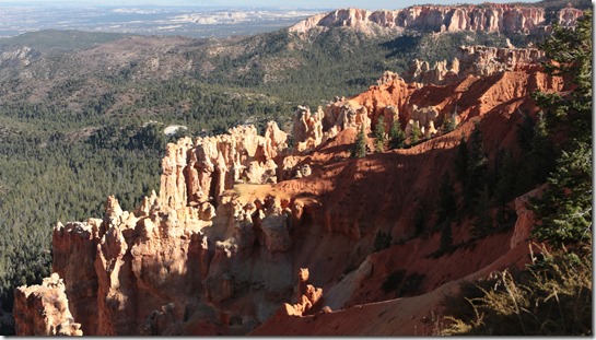
Driving back toward the park entrance we stopped at Ponderosa Point, Agua Canyon, Natural Bridge, and Fairview Point, before turning into Bryce Canyon Overlook.  The view from each of the turnouts was inspiring.  Surprisingly I found parking for Li’l Beast at each turnout.

At Bryce Point I had difficulty parking and eventually took two back to back spaces.  It was a tight fit, but we made it.  We loitered at Bryce Point marveling at the indescribable structures wind and water have carved in the land.  The hoodoos look so fragile, yet are so strong.  A cold wind swept the point.  Eventually we retreated back to the Beast.  We warmed up as we drove to Sunset Point.  The traffic in the sunset loop was moderate; parking was easy.  Again the view from the overlook was astounding.  With a rudimentary knowledge of geological processes, I can begin to understand how Bryce Canyon evolved.  It’s nearly impossible for us humans to comprehend action over geological timeframes.  That small actions integrated over huge time frames can result in a Bryce Canyon requires an intellectual leap coupled with scientific theories.  An understanding of how Bryce Canyon came to be is unnecessary.  Inquiring minds will always ask why and look for answers.  Still an understanding of how or even why is secondary.  We humans are drawn to beauty.  Bryce Canyon is startlingly beautiful.  It evokes an emotional response rooted deep in our collective past.  

IMG_4594

One View from Bryce Point

IMG_4590

There’s always some Idiot in the Crowd (me off trail?)

IMG_4604

Fragile?

IMG_4605

HooDoos Look So Delicate

IMG_4606

IMG_4611

IMG_4618

But They are Strong.

IMG_4623

Ellen: Cold, Happy, & Hungry

As the sun set, we chose to go to The Lodge at Bryce Canyon for dinner.  It brought back memories of our dinner with Chris at the Old Faithful Lodge.  We could eat without leaving the park. Rudy’s RV Park was just outside the park.  Life was simple.  Parking was a bit tricky, there were no RV spots.  We backed into a spot with a bit of overhand on both sides.  It was getting cold.  Our walk to the lodge was frigid. The lodge is rustic, though not nearly as rustic as the Old Faithful Lodge.  There was a line of couples waiting for a table.  We were seated in less than five minutes and right by forced air heaters in the wall beside our table.  We went from frozen to comfy quickly.

For dinner Ellen had stuffed Poblano chili.  I splurged with a Filet and a glass of Cabernet. Though not superb, our dinner was just what we expected.  Good solid fare, tasty if straight forward with no surprises.   We left nothing on either plate.  I recommend the lodge for dining within ten miles of the park.

Back “home” we hooked up, couldn’t bring in DirecTV satellites, chatted about the day, and hit the sack.

Plans?

We’ll get up early enough tomorrow to find parking and hike the Navajo Loop Trail to the Queens Garden Trail from Sunset Point to Sunrise Point.  This is the route Han had raved about when we helped them in Capitol Reef.

10/23/19, Escalante Slot Canyons, Day 43

IMG_3528

Waiting for Cody

Canyons of Escalante RV Park

Good Morning Viet Nam, errr Escalante.  Overnight low temp was 40 F,.  Today will be a warm day.  We’re up, coffee has been made, CNN is on in the background.   I called High Adventure Tours to say “We’re Going.  Yes, that’s us.  We’re at the RV Park by the Circle-D”.   Pickup time was 8:15. Time to pack. 

Sunrise with temperature at 47 F.  Seven liters of water packed.  I think this is too much water for this time of year.  I suppose if a party gets lost, carrying “too much water” could be a life saver.  Ellen has 3 liters in her platypus I’ll carry four, three liters of electrolytes and a liter of water.  For a day pack, my pack is pretty heavy.

IMG_0965

Cody in Control

IMG_3531

Off to the Canyons, Cody said “Have Fun”!

IMG_3532

That Slot Center Right?  That’s Peekaboo.

IMG_3533

Wide Open Terrain!

Cody

“A green jeep will pick you up.” Cody arrived in a short dark blue jeep.  Ellen crawled in the back with our packs.  I struck up a conversation with Cody as he drove off.   We went to High Adventure to finalize paperwork then we were off.  Just before we took off, Cody suggested we download Hiking Project and load the Utah map. The drive to hole in the wall road is fast and smooth on a paved road.  Hole in the wall road is dirt, pebble, and rock.  Cody drove the road at 40.  He knew the road well. He’s off for the season in two days. He lives in St. George and is going home.  His birthday is in two days,, the 25th. My birthday was on the 3rd.  We talked about the geology, traveling, and Italy.  He and his two brothers went to the Amalfi Coast and loved it.  They’ve been to Rome and Florence on a different trip.  We talked about Banff and Glacier National Park.  Cody is well traveled

We bounced along Hole in the Wall for about 45 minutes. Cody slowed and said, “This is as far as most people bring their cars.”  Ahead was a slick rock formation that the jeep handled easily.  The trail head was about another hundred yards more.  

Cody, at the trail head  “You can see the entrance to Peekaboo.  You see the valley that goes to the left past the near rise?  Just to the right you’ll see the entrance..  Once you hit the bottom, the trail runs into a dry riverbed. Don’t go left and don’t go immediately right.  Go diagonally across the wash and you’ll run right into Peekaboo. Once you’re through Peekaboo, fallow the cairns to the right.  If you loose the cairns, back track until you pick them up. In spooky you’ll come upon a pile of boulders.  There’s a 12 foot drop there.  People do climb down, but there’s a easy way.  When you see the boulders, behind you you’ll see a hole.  Go down that hole and you’ll find another smaller hole that will lead you down.  Have Fun! I’ll meet you here at 1:30.”   We headed down the trail at 9:30.

IMG_3538

Our First Slot Canyon Ever!

IMG_0988

IMG_3539

The Climb into Peekaboo

IMG_3542

The Family on the Way Up.

IMG_3543

Amazing, Simply Amazing.

IMG_3544

Here and Gone, Moving Fast.

IMG_3545

Peekaboo Does Not Disappoint!

IMG_3546

IMG_1001

IMG_3548

IMG_3549

IMG_3555


IMG_3558

IMG_1004

IMG_3562

IMG_1006

IMG_3566


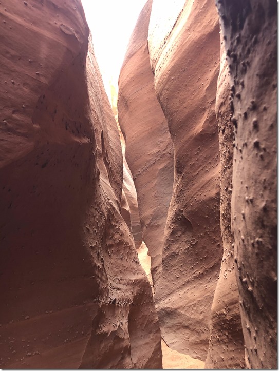
Peekaboo Slot Canyon

People miss Peekaboo.  Often they take the wrong path.  Sometimes they walk right by the entrance.

The trail from the plateau to the valley floor is steep.  Switchbacks run through sand and over slick rock.  We found it easier to take the slick rock and cut the switchbacks now and then.  We started out very tentatively, not trusting our boots and not feeling comfortable traversing a slope. As we hiked we heard voices behind.  I love quiet while hiking.  It’s fun to listen for novel sounds.  I was not happy having people so close. Near the bottom a family of four with a dog passed us headed on.  At the wash, they went left which took them up the canyon.  We followed Cody’s directions and found the slot canyon, Peekaboo.  The family backtracked to follow us.

There is a climb to get into Peekaboo.  The first eight feet are easy.  The next eight feet were difficult for us.  We made it up the easy part as the family watched from below.  I prefer to have Ellen lead.  If she is uncomfortable with a route, I’ll help or lead, but I think she develops confidence picking her own path.  Ellen was having trouble getting up the second pitch at Peekaboo.  It wouldn’t help if I went ahead, she’d still have to make that climb.  The husband below  said, “I have webbing.  I could go ahead and help you up.”   “Sure”, we said.  He wore climbing shoes and easily bounded up the pitch.  At the top he lowered a strap that Ellen used to pull herself around a corner and up.  I used the web too.  Then we watched as his wife climbed the pitch carrying their whippet.  Then there two young children bounded up the pitch. The kids were like spiders on a wall; amazing.  What did I say about solitude?  I was very grateful to this family for their help.

Mark said he had two straps.  We could borrow one if we get it back to his van when we’re done.  OK. I put the strap in my backpack.

The little I read about Peekaboo mentioned the climb at the entrance as difficult, but nothing else.  The walk through the rest of the slot canyon is easy, right?  No.  In many places the footing was so narrow my boot was wedged between the two walls. Sometimes I’d have my boot wedged while trying to work my way around a sharp narrow opening that dropped down three or four feet.  Getting through Peekaboo was challenging and big fun.  It’s a long slot canyon that opens out as if it’s over then closes down again and continues.  Often we could see sunlight above just as often we couldn’t.  Ellen led the way through the entirety of Peekaboo.  I’m very proud of her.  She was having a ton of fun.  Often we couldn’t fit through a section with our packs.  Ellen would go ahead and I’d pass the packs to her.  Sometimes she carried both packs!  Peekaboo is incredibly dramatic; it is beautiful and challenging.

We started hiking with three layers; the last being a light weight down jacket.  In Peekaboo, we packed the down away.  It was comfortable hiking weather.

IMG_1019

The Entrance to Spooky

IMG_1021

IMG_1024

IMG_1027

IMG_3581

IMG_3580


IMG_1045

IMG_1050

IMG_3588


IMG_1065

IMG_1071

IMG_1082


Spooky Slot Canyon

People sometimes miss spooky.  How, I don’t know.

Exiting Peekaboo we followed cairns to the right.  We were both a bit down.   Peekaboo had ended for us.  The trail toward spooky is so well marked with cairns, it’s nearly impossible not to find the entrance  It is a bit of a hike, the two canyons are not side by side.  Stranger still, the last few hundred feet of trail goes down hill.  I checked Hiking Project’s map and found our “blue dot” (the you are here marker) nearly at the entrance to Spooky.

Spooky’s entrance gives nothing away about what’s coming.   Spooky narrows then narrows again.  We found ourselves walking sideways through S bends so narrow at times that I had to exhale to get past.  There was no way to wear our packs, we carried them in our hands. Ellen led.  Now and then I’d have to pass the packs through to Ellen to get through a narrow. The slot canyon is gorgeous.   Before long we came upon a jumble of boulders in a open area.  We walked/crawled to the edge of the last boulder and saw a precipice.  A sheer drop of twelve perhaps twenty feet.  How do we get through? 

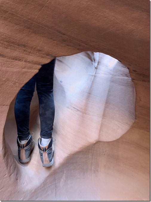
We looked all around.  There was a hold under the last boulder, but the drop looked to be eight or twelve feet; too much.   Back at the beginning of the boulder pile, there was no opening.  We did see a small hole with a three foot drop to a rock and a sandy floor.  Because I didn’t know where that led, I went down the hole first.  It was easy to drop in, but I dropped into the dark.  With my iPhone flashlight, I saw another hole, big enough to get through.  That path led over a small boulder, perhaps four feet in length that dropped into a  sandy bottom.  I told Ellen, “This is it!  Come on down and you can get through the hole down here.”  I helped her footing down to me and pointed out the hole.  Without missing a beat she was through the hole and down.  The packs went next and I followed.  I had a bit more trouble getting though the smallish hole.  We were down.  Thank You Cody!

Getting Through The Holes

IMG_3591

Could This Be The Way?

IMG_3592

I’m In the 1st Hole looking up at Ellen

IMG_3593

Looking Down to the 2nd Hole

IMG_3594

Ellen Dropping In to the 1st Hole

IMG_3596

Ellen dropping into the 2nd Hole

IMG_3597

We Made It, Looking Back

IMG_3600

The Boulder Jam was Just the Beginning!

IMG_3603

IMG_3610

IMG_3612

IMG_3617

Pumped

As we worked our way past the boulders, we heard a couple above us.  They were clearly having the same misgivings about the drop that we had.  We guided them to the easy way down then went on ahead.

I doubt I could get through a narrower canyon. At one point the channel was so narrow I had to crawl.  I couldn’t stand.  Now and then I found a foot wedged and I couldn’t move forward, I had to back up and free my foot.  Ellen had her share of difficulties too.  The challenge made getting through that much sweeter.  This is the same woman who just last night was concerned about how much water to take,  how would I do with my bum shoulder, will it be too difficult, should we go at all, and so on.  Once in the canyons, Ellen was excited and enjoyed overcoming hazards. 

The couple behind us caught up.  We walked together into the sunlight. We were sad once again to burst into the open from the canyon and overjoyed at the experience. The sun was high; the day’s heat was building, off came another layer of clothing.

The path back to Peekaboo went quickly. We had seen seven people on our Hike before returning to Peekaboo.  On our way up to the plateau, we encountered a number of small groups , perhaps thirty in all.  Some planned to do Peekaboo and Spooky.  We described Cody’s “easy” way down in Spooky.  At one point Ellen said,  “I don’t like getting up early. I’m glad you pushed for an early start.  Look at the number of people and the heat now.”

We finished the loop through Peekaboo and Spooky early and took the path to Dry Fork Narrows to cool off.  Dry Fork Narrows is an easy walk through impressive red rock walls.  It is a great experience too, but not challenging whatsoever.   At some point we turned back to be sure we got back in time.

Info Peekaboo and Spooky Slot Canyons

Info Dry Fork Narrows


IMG_1094

Dry Fork Narrows

IMG_1098

IMG_1100

IMG_1103

Leaving Dry Fork Narrows

IMG_3624

It’s Over? Looking back at Peekaboo.

Cody was waiting for us as we crested the plateau at 1:15.  “Are we late”, Ellen asked.  “No, early”  Cody drove as he did coming up, perhaps even faster.  We looked for the family’s van at the first and second parking lots. There were cars at both, but no van.  Cody said he noticed a van parked a bit ahead on his way in.  We pulled up beside the  van.  “No Way!  We were just about to leave”, Mark was so happy that we stopped to return his webbing.

The drive back was fast and uneventful.  Two times we trailed another vehicle.  The dust storm they kicked up was horrendous. Fine sand filled the air and seeped into our Jeep’s cab. At times the road ahead disappeared. Cody managed to pass both of them on open stretches as we bounced along.  “It’s good to have fresh air again!”, I said.  “You should see this road on a busy summer day.  This was nothing.”  Yet another reason to visit on shoulder seasons. 

Cody mentioned that Peekaboo and Spooky were named by a group of school children on a Halloween outing.   Appropriate names!  You would not expect a slot canyon hiding behind that initial wall.  As for spooky, getting down and around that boulder jam was damn spooky.  We’re closing in on Halloween in a few days.

You might ask which canyon is “better”.  There is no “better”, they both are very different and yet the same.  Both are fantastic  Both present challenges that are easily surmounted.  These slot canyons are not for everyone. Moderate strength and endurance is necessary.  Anyone who is heavily overweight will not make it through Spooky and probably couldn’t make Peekaboo’s climb..  For everyone else, I strongly recommend taking the “trail” through Peekaboo and Spooky slots.  Take the clockwise route and enjoy!

Kodachrome State Park Campground

We bumped into Debbie back at the RV Park. “How did you like it”  We gushed about our experience and thanked her for letting us stay well past checkout time.  We stowed “everything” and set off around 2:40.  Checkout is typically 11 AM.

Before heading off we took cash out at our bank, dropped of a tip for Cody and returned our 911 device, gassed up, and got more ice for our glorified ice box (failed fridge). ; While getting gas, we saw Mark pulling out.  He turned around and lowered his window, “Happy Adventuring!”, he said as the family waved.  They’re out for two weeks.  Perhaps we’ll meet them again.

We had met two Winnebago View owners in Capitol Reef.  We bumped into them again at Escalante Petrified Forest campground.  They mentioned going to Kodachrome State Park Campground next.  Judy, a women we met at Canyons of Escalante RV Park, also mentioned Kodachrome as a great hiking destination.  I punched the state park into our GPS and we drove off.

I kept our speed down and enjoyed a relaxing ride to Cannonville and south to Kodachrome.  The campground at Kodachrome is first come first served.  We arrived late in the day thinking we’d have to drive back to a KOA.  We lucked out!  Ethan had a few spots open.  We merrily drove off to site 29.  Yup, the two View couples are here.

The campground sits in a small circular canyon.  The view is great, the showers are amazing.  I have never seen a campground with fully tiled shows with a rain head and a hand wand.  The showers are large with two seating areas.  One fellow said,  “This is better than the shower I have at home!”  Seriously, the showers are amazing.

Plans

We are comfortably exhausted.  We’ll hit the sack early tonight.  Do we hike here or go to Bryce tomorrow.  People use this campground as home base for visiting Bryce, a short 30 minute drive away.  we’ll play this one by ear.

Bonus, some Video

You’ve made it to the bottom of today’s blog entry.  I didn’t take time to video much.  We were both too busy helping each other navigate the slots.  I did take some.  Here you go.

Peekaboo Slot Canyon, Escalante Staircase

In Spooky Slot Canyon, past the boulder jam

Exiting Spooky Slot Canyon, Escalante Staircase